Choquequirao Trail
$450.00/From
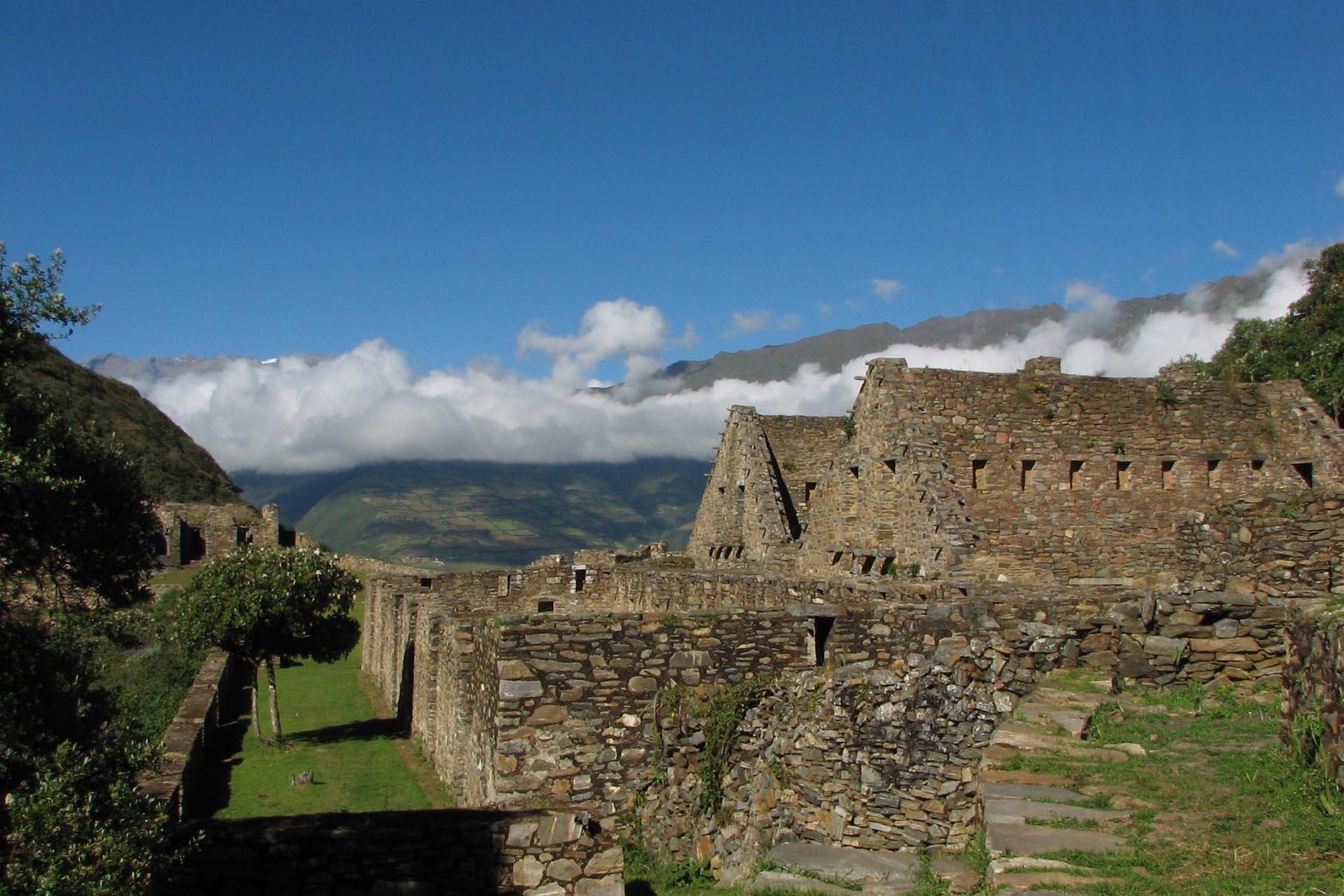
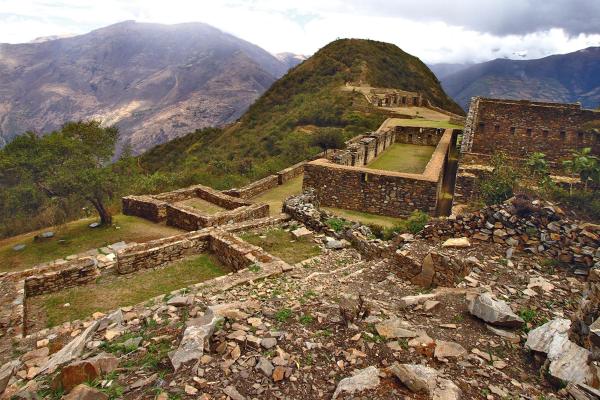
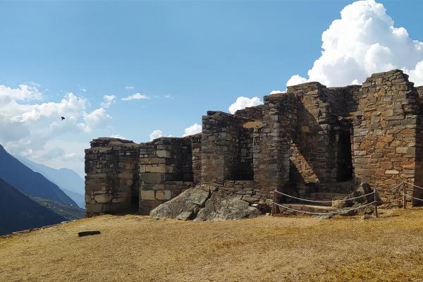
Choquequirao, the sister city of Machu Picchu, considered so for its architectural and structural similarity. It is another "lost city of the Incas" officially rediscovered at the end of the 20th century, located at 3,050 m.s., high on a mountain at almost 1,750 m. above the mighty Apurímac River, fed by glaciers and surrounded by the imposing Salkantay and Humantay snowy peaks.Considered by many who visited it as the other Machu Picchu and sometimes many tourists dare to say it is better than Machu Picchu. The best thing about this archaeological center is that you can only get there by walking, there are no railways or roads that can take you to or near Choquequirao, so it is full trekking, many tourists consider this trip as a pilgrimage, an escape from the routine, a challenge of your own, or just escape from the bustle of the city.This archaeological site has recently gained a high level of importance and both tourist and cultural curiosity. Choquequirao is located in the jungle, which is the transition from the Andean valleys to the jungle. Life in this area belongs to those given in dry, montane and sub-tropical forests. The confluence of these environmental variations makes it an important attraction for visitors to observe the diversity of the fauna and flora of the place such as the spectacled bear, the condor, colorful butterflies and birds like the trogon (a bird similar to the quetzal)From the Andean perspective its location is undoubtedly strategic, which allowed this unique settlement to encompass and have a mastery over what could be considered one of the most extraordinary altitudinal routes in the country.A spectacular landscape of isolated Inca ruins and little traffic of people also with the promise of a difficult hike to cross the Apurímac canyon. Little more than what we are used to. A great physical challenge to reach the top of this mountain. Choquequirao, in Quechua"Chuqi K'iraw", that means the golden cradle.Don't miss the opportunity to know this natural and sofisticated hiking tour.
Quick Itinerary:
- Day 1: Cusco – Cachora – Chiquispa.
- Day 2: Chiquiska – Playa Rosalina – Sunchupata.
- Day 3: Sunchupata – Choquequirao – Chiquiska.
- Day 4: Chiquiska – Capuliyoc – Cachora.
Highlights of Choquequirao Trail
- Explore the second lost city of the Incas - Choquequirao
- Guided Tour of Choquequirao citadel
- Look up the sacred mountain of the city
- Discover the Llama terraces
- Enjoy the beautiful landscapes offer of the mountain
Location:
It is located at 13° 32' south latitude and 72° 44' west longitude. It is located at 3035 m.a.s.l in the foothills of the Salkantay mountain, north of the Apurímac river valley, in the province of La Convención in the department of Cusco. It is approximately at a distance of 47 km. with reference to the town of Cachora (department of Apurimac). We can mention that the environment of Choquequirao is one of the richest in biodiversity. All these species have been conditioned despite the temperature variations such as sunshine throughout the day and inclement frost during the night. The fauna of the place is composed mainly of condors, tarucas, vizcachas, foxes, zorrinos, pumas, hummingbirds, bears of spectacles and the popular cock of the rocks, national bird of Peru. In its flora, giant ferns, ichu and a great variety of orchids stand out, where the wakanki variety stands out.
Description of Choquequirao:
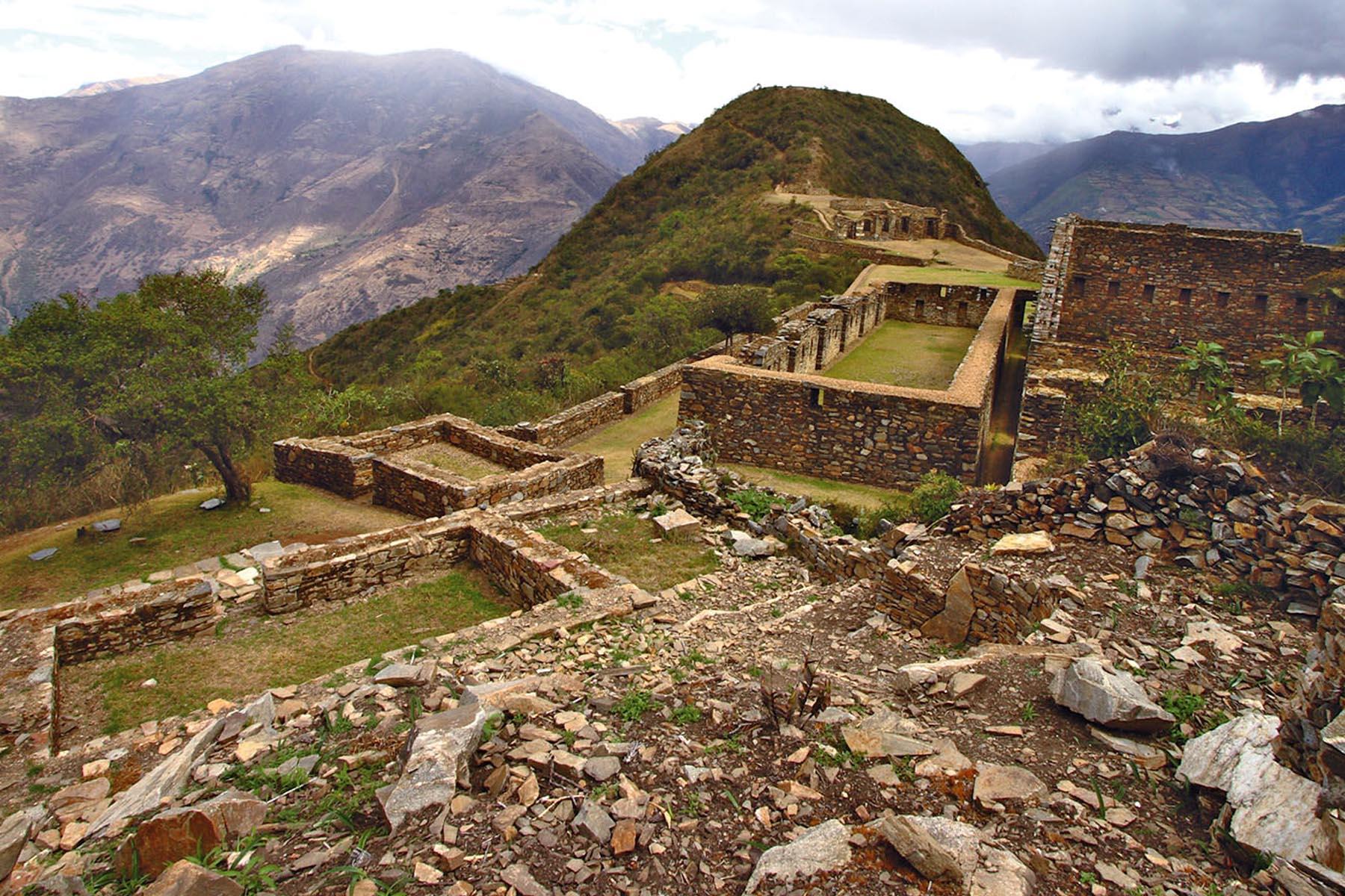
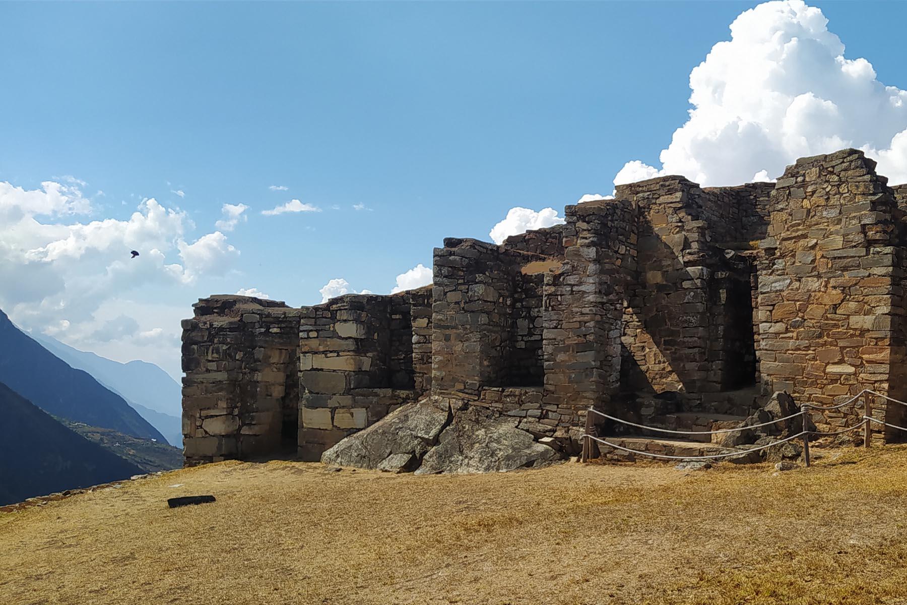
The complex of Choquequirao is composed of nine sectors, among which the religious political center, the system of fountains, canals with aqueducts, and the group of the portals stand out. The terraces of Choquequirao.
Topography:
From an aerial view or a certain distance, it is easy to distinguish the typical Inca terraces that make up the largest constructions of Choquequirao. A Temple, some administrative buildings and rooms for the administrators and main advisers, that were located around the central square. On the outskirts of the center of the citadel are the rooms used by the rest of the population, which are grouped into a small village. In Choquequiero there are numerous irrigation channels, and aqueducts for the supply of drinking water. Despite the weather and the inclement weather, most of the buildings of the "sacred sister" of Machu Picchu are well preserved, and its restoration will last, according to some experts who are in charge, even several more years.
Strategic position:
Apurimac Canyon seen from Choquequirao From the Andean perspective, its location is undoubtedly strategic, which allowed this singular settlement to encompass and have a mastery over what could be considered one of the most extraordinary altitudinal routes in the country. In turn, from the air the researchers, who have appreciated it, say that Choquequirao is shown as a large open book, with the mighty river Apurimac at its feet and a large mountain range that rushes towards the eastern slopes covered by an immense tropical vegetation; being another sample of the Andean pretension to dominate the world from above.
Weather:
Due to the geographical position in which it is located, Choquequirao has a warm climate alternated with cold temperatures at night. The average annual temperature is 17ºC.
What is the best time to travel to Choquequirao?
The best time to go is from May to December, avoid the rainy season because it is to difficult to walk or do some activities with your shoes full of mud, but it is more beautiful to see everything green so it can be done at any time of the year.
Biodiversity:
The environment of Choquequirao is one of the richest in biodiversity, biologists, ecologists and experts mention it, however in this area, it is not known exactly the number of species in plants and animals that exist, despite this deficiency and From the few scientific studies carried out, it has been possible to determine the existence of different forms of life. Among the most relevant species are: Condor, fox, skunk, puma, spectacled bear, taruca, vizcachas, pica flowers, tall tucan, quetzals and tigrillos. All these species have been conditioned despite the temperature variations such as the sun throughout the day and the icy inclement during the night. This space can also be appreciated the cock of the rocks, national bird of Peru. The flora of the place is composed by giant ferns and a great variety of orchids, where the wakanki variety stands out. At the bottom of the great valley and under the thermal effect of the watercourse that runs through it, the forests of the mountain brow provide its warmth and ideal conditions for an enormous variety of coca crops, achiote, corn, cocoa, coffee and fruit trees. From the environmental point of view, the main value of these ecosystems presented exuberant forests that grow in the high parts of the mountains for the maintenance of the water balance of the region, capturing the rainwater and driving it without causing erosion towards the Apurimac river.
Why is it so incredible and so few people go or little is known about it?
Unlike Machu Picchu, where you can get to with trains and get on buses, Choquequirao is a destination that is reached through an intense sacrifice and effort. They are hard walks that involve lowering and unevenness with little oxygen. The way to get there is by walking a lot and camping. Possibly your water supply is not enough, you pass cold in the heights or you burn yourself walking under the intense Andean sun. The entire trip can be made between 4 and 5 days unless you want to visit some nearby towns or do it quickly.
How far is the walking to Choquequirao?
From the town of Cachora to Choquequirao, the walk is around 31 kilometers without including the route through the ruins. Back would be the same distance (62 km in total). A large part of the route involves the descent of a large mountain while the other half is climb.
What is the degree of difficulty in Choquequirao?
Choquequirao is still one of the most memorable experiences around the world, but physically it is stronger than any other road in Cusco, 166 kilometers, but especially the 4600 meters of altitude is a real physical challenge , especially if you decide to do it until Machupicchu between them there are two ports to cross at the level of 4,600 meters. We believe that it is not necessary to be an experienced hiker to make this trip but we recommend that it would be better to rent an extra horse and acclimatize 2 or 3 days before done Choquequirao hike in the city of Cusco.
More Tours:
- Short Salkantay Trek
- Cachicata to Machu Picchu
- 5 Day - Choquequirao Hike
- Ausangate Trek
- Salkantay Inca Trail Condor Sight
Tour Plan
Day 1: Cusco - Cachora - Chiquiska
Our team will pick you up from your hotel at 06:00 in the morning to transfer you in a private van to the Cachora town. During the route we can see the Inca ruins of Tarawasi. Then continue to the Cunyac bridge between the departments of Cusco and Apurimac, then pass through the district of Curawasi and Saywute to finally reach Cachora (10:00 approx). From this place we will start our walk along a gently sloping path to reach the pass of Capuliyoc (2800 masl) and place our lunch after two hours of walking, then we will go to the town of Chaquisqa (1930 masl). The trip is downhill and the landscape is breathtaking, beautiful and the weather is warm, it is three hours of walking.After two hours, we will arrive into Capuliyoc (2800 MASL), where we will appreciate beautiful landscapes of the Andean highlands. After three more hours of walking, where we will appreciate fields of culture and other Andean landscapes, we will arrive at the Chiquiska camp (1550 m.a.s.l).
Day 2: Chiquiska - Playa Rosalina - Sunchupata
After breakfast (5:00 am), we will continue with our trekking towards Rosalinas beach (1550 masl), then climb the very early slope towards Santa Rosa (2100 masl) instead of our lunch, this trip is the most difficult which we will do in three hours, then ascend to Maranpata (2850 masl) which is a smoother ascent during this journey you can see all the way of the first day and the vegetation that exists in this place then we will travel a straight stretch in the direction of Sunchupata that in this place we will have our camp and that the walking time is two hours, from here it is one hour to Choquequirao.
Day 3: Sunchupata - Choquequirao - Chiquiska
This day we will have breakfast early and we will make a one hour walk to reach our final destination: the archaeological complex of Choquequirao. Our guide will take you through every corner of the complex with a detailed explanation of the history and architecture of Choquequirao. The visit lasts approximately three hours, after which we will start the way back. We will walk to Santa Rosa, where we will have lunch and continue the walk to the Chiquiska camp.
Day 4: Chiquiska - Capuliyoc - Cachora
We will have breakfast very early and start the return. On the route we can appreciate a view of the Salkantay and the Apurimac Canyon. We will arrive at the town of Cachora where our van will wait for us. Finally, we will arrive to Cusco in the afternoon.
Included & Excluded
Details about services not included and details not included in our packages, if you have any questions please contact us.
- Pre-trek briefing.
- Private transportation to Cachora
- Accommodation: Campsites (3 nights).
- Entrance fee to the Choquequirao.
- Meals: 3x breakfast, 3x lunch, 3x dinner and 3x afternoon hot beverages
- Professional bilingual Tour Guide.
- Professional Cook.
- Horses to carry food, camping and cooking equipment and 5 kg of each passenger's stuff
- Camping equipment: tents, sleeping bag, tables and chairs, a cooking tent with cooking equipment, dining and toilet tents.
- Duffel bag
- Breakfast on the day 1 and lunch on the last day.
- Travel insurance
- Tips to local staff
Suggested Items
- Copy of your passport
- Warm clothes (wool caps, ponchos, gloves, jackets)
- Sun hat, sunscreen, mineral water and personal medications
- Cameras
- Extra money
Frequently Asked Questions
Appropriate clothing along this hike:
Trousers and hiking shirts are recommended during the day, eventually complemented by sweaters, and jackets in the afternoon. We recommend convertible walking pants and / or shorts, as some parts of the route run at low altitude and warm weather. It is also very convenient to have light raingear available in the backpack (rain poncho or jacket and / or rain pants) as the weather changes easily and the rains may occur suddenly. At night, warm clothing is required along the route.
Choquequirao Trek Weather:
The climate of Cusco is divided into two distinct seasons: the rainy season, from November to April (the strongest rains generally occur between January and March); And the dry season, from May to October. The dry season is colder, so temperatures can drop below 0 degrees at night. Along the route to Choquequirao, the temperatures oscillate between 15-25ºC during the day if it is sunny, at 10-20ºC during the day if not sunny. Temperatures go down at night, especially in Choquequirao, at a higher elevation, reaching 5ºC but rarely below. The warm clothes are therefore necessary for this walk.
Choquequirao Trek Difficulty:
Very difficult: The route has strong ups and downs, with changes in altitude on a day of more than 1600m / 5200 feet and generally warm weather during the day due to low altitude vs. Cusco. We recommend allowing an acclimatization of a day in Cusco before the departure of the walk.


